Search This Blog

Monday, March 28, 2011

St. John's Church and Hollywood Cemetery

Now for something a little different....

I am an avid history buff (code for nerd). Was feeling my roots in the peoples of the British Isles so I attended the Irish Festival in Richmond, VA yesterday.

The festival was RIGHT next to St. John's Church. This was the site of the Second Virginia Convention in 1775 and where Patrick Henry delivered his famous, "Give me liberty of give me death" speech.


400 years of Henrico Parish
 Well, since I was on my "history kick", I decided to travel the arduous (sarcasm) 3 miles over to Hollywood Cemetery to visit some Confederate relatives interred there. For anyone that has not visited the cemetery, many notable Virginians have been laid to rest there. There are many of my family's surnames represented by distant cousins including; Gray, Dulaney, McCormick, Lee/Lea/Leigh, Harrison, Jessee, Stephenson and others.
Relative of my Granny on Mom's side (Frances Dulaney Muck) who was actually in the same Company as my gg-Grandpa on Dad's side (Robert Emmett Bradley Gray).

Friday, March 25, 2011

Squirrel Dog Blog

In case anyone is interested, I started a squirrel dog specific blog. The images and videos are of squirrel hunting with dogs. If that is not your cup of tea, than please stay on my Wildlife & Outdoor Adventure Blog to view pictures of wildlife science, hiking, paddling, camping and the like. Thanks!

Gray's Mountain Feist Blog

Sorry for the disclaimer but just giving fair warning that some material might be offensive to some folks. I participate in a wide variety of outdoor activities and enjoy spending time in the timber with my dogs.

Wednesday, March 23, 2011

New England

Old picture of me with Trigger on Mt. Waumbek, along the Star King Trail in the White Mountain National Forest. I am sitting on the fireplace of an old AMC hut that is no longer standing. I did a lot of hiking and climbed many mountains while I lived in New England for college between 2002-2006. Spent a lot of time outside in general. Tagged a few of the "4,000 footers".


Some additional trips included destinations in Maine, New Hampshire, Vermont, Rhode Island, Connecticut and Massachusetts. A VERY abbreviated list includes:

Mooselauki 
Monadnock (multiple times)
Wachusett
Waumbek

Also, the Dry River Trail was a great backpacking trip! And canoeing/staying in a cabin on Mooselookmeguntic one summer was a blast!

Windblown is an awesome cross-country ski/snowshoeing resort.

Worked one summer at Sunkhaze Meadows National Wildlife Refuge and lived in a remote cabin without electricity or potable water...Ah, rustic! The name of the place was the Thibodeaux Cabin.

I will try and dig up some photos from some of my New England expeditions.

Arkansas State Record Bald Cypress

During grad school in South Dakota, my Waterfowl Ecology & Management class went down to the Mississippi Delta to learn about what was being done for waterfowl at the other end of the flyway. We spent time in the Bootheel of Missouri and Northeast Arkansas. At White River National Wildlife Refuge, we were taken to see the alleged (for good reason) State Record cypress tree.

Here I am on the "uphill" (it is the Delta) side.   

The entire class in front of the cypress.

Tuesday, March 22, 2011

A voice for the Piedmont

Wetlands are protected by law to promote water quality and subsequently, produce various other benefits to Society such as fishing (recreational and commercial) and hunting. This is due to the large number of species which spend at least part of their life history events in wetlands.

Mountainous regions are protected due to their erodibility and especially in the Southern Appalachians (http://www.appalachian.org/) their high biotic diversity.

Please keep in mind that "protected" may mean any combination of conservation and preservation. Essentially, conservation = wise use and preservation = no use (Conservation vs. Preservation). There are instances to implement one principle over the other or use some combination of both, as in natural area reserves that exhibit concentric spheres or differing degrees of land use practices.

The idea has been applied ot various disciplines including urban social structure (Burgess Model). The concept in natural resource planning involves placing the least used (i.e., wilderness) at the center with increasing amounts of human activity (i.e., agriculture, forest product extraction, human habitation, etc.) in bands moving out from the center. So, in essense a reverse of the theory applied to urban settlements where the highest density of people is located at the center.

But, I digress....

The Piedmont Region has largely been ignored by conservation and preservation organizations but the time I hope is coming. We need a voice for the Piedmont. Farm and timber land (i.e., the coveted "open space") is disappearing from the landscape. The most meaningful set asides have come in the form of State Parks, Wildlife Management Areas, State Forests and notably here in Virginia; in our various historic National Battlefields. County and city parks also contribute to keeping open space on the landscape.

National Wildlife Refuges primarily occupy coastal wetlands that are important areas of migratory birds and National Parks tend to have larger tracts in scenic mountain areas (the exceptions are the battlefields previously mentioned). The National Forests are large but are primarily west of the Blue Ridge.
Private land trusts and non-governmental organizations too have looked to the sea or mountains in their priorities for land conservation and preservation.

Land-use planning for the Piedmont seems to have been an unspoken "it's not a wetland nor highly erodible, so let's build on it!" The human population in the region is growing and looks like it will continue to do so with what appear to be entire towns in the Northeast or Midwest emigrating to central North Carolina and other Piedmont states. Wildlife habitat is being fragmented by an expanded road system feeding the increasing sprawl of the urban centers along the eastern edge of the region. Open spaces are being disconnected because corridors between them are filling in with residential and commercial development. Homes are built abutting our state parks, wildlife management areas and other reserves. Suburban zones spread outwardly more or less uncontrolled. Commutes are increasing as people choose to live on mini country estates (a few acres) rather than in a suburb (fraction of an acre lots) or city apartments.

The land being built upon are the Piedmont's farms and woodlots. How can we sustain the current buzz about "buying locally" if there isn't even room for gardens? Okay, I am taking things to the extreme but the rampant growth seen in the region over the past couple decades has to make you think, "where will it end or what will we do about it?" It is not difficult to envision an ever-expanding zone of human habitation, because in many localities, it is happening.

It's not that I am speaking out about all development during these rough economic times. There are plenty of places to rent or buy right now (not going to digress again). We just need to look ahead and think about the process and consider ways to wisely move forward. Ten years from now, if things don't change, we are going to wish we had a little more foresight. How hypocritical is it to shout for the conservation and preservation of exotic, overseas places when we continue to pave our backyards?   

Monday, March 21, 2011

Missing that which is lost

Maybe it's my education or perhaps just my personality but I have a tendency to mourn the loss of things we can never get back...certain people, species and places. Today I missed a place that for much of the last decade, I did not. I spent my high school years to the present being disgusted by the rate at which development was changing the town I grew up in. My friends and I spoke out against building subdivisions consisting of hundreds of homes and rampant commercial developement.

Alas, over the past 10-15 years so much of my life was paved over. Office buildings and strip shopping centers were built in anticipation of a future need, while available space for lease sat empty. The recent financial crisis slowed ground breaking but now more than ever structures are sitting empty and beginning to fall in disrepair. Some construction continues...

Parks are being surrounded by homes, roads are now much wider, the human population has grown (for lack of a better word) exponentially. Schools are over-crowded and services are strained. Traffic on the widened Rt. 10 is insane!

Chester, VA has changed quite a bit over the last decade or so. It has gone from an area where most people knew each other to hardly knowing anyone at all. "Old families" still persist but the culture is being swamped by people that recently moved to the area. My own family is somewhere between the old and new residents of Chesterfield County, having relocated there in the 1980's. Even so, Route 10 at that time was a 2-lane road and a drastic amount of the current development was absent. For more information about the demographics of the area, check out the following link: http://www.city-data.com/city/Chester-Virginia.html

Every time I returned to visit on breaks from school, it seemed that the number of restaurants or stores or houses doubled. An abbreviated list (off the top of my head) of businesses that sprang up since high school include:

Uno's
Home Depot
The Chester Village (how many shops are in there anyway?)
New Lowe's
Kohl's (In the 2nd Lowe's building...anyone remember the old Lowe's farther east on Rt. 10?)
Starbuck's
All that stuff by Wal-Mart (Wal-Mart isn't THAT old either)
*There is much more. What is truly disturbing is the number of housing developments now.

Recent map of Chester ---> Click here

Farther west, another free-standing drug store was built literally in the back yard of Castlewood and the rest of the Chesterfield Meadows area around it and Magnolia Grange (http://www.chesterfieldtourism.org/castlewood.shtml) is hardly recognizable. What happened to our reverance of history? I remember when the intersection of Beach Road and Rt. 10 had a bean field on the southwest corner (everything in the proximity of Ledo's Pizza) and the northwest corner was a lumberyard.

I hate to say it, but Chester may be lost. The place I missed today is long gone...I now remember my way around based on where things USED to be rather than what is there now. Does anyone remember; Grundy's General Store (now Sibley's Barbeque), Ward's/Miss Swiss (now the Village Grill), Safe Way/Chuck's Market (now CVS), Ukrop's (now Martin's), Feed & Seed (now boarded up), Litchfield Cinema (another drug store)? More recently, how about Chester Middle School (now 9th grade of Thomas Dale High School)?

Friday, March 18, 2011

Way to End the Day

Sunset on the farm

Fresh start

I am planning my garden, laid it out, broke the ground and started the veggies inside today. The soil will take some amending, but it should be decent when all is said and done. Currently its all clay with iron, and has proven to be a little rocky. Here are some pictures. We are planning to have the following: Tomatoes, Sweet Corn, Onions, Squash, Zucchini, Carrots, Watermelon, Cantaloupe, and Strawberries. We also stated a little Herb garden that looks like it will stay inside, but if it grows well we plan to transplant it outside to join the others. The Herb Garden has Oregano, Basil, Thyme, and Parsley.

Herb Garden
Breaking ground in our garden.
Starting containers (cause we still will fight against frost).  Hoping to have the corn sprout to the 3 leaf stage so the crows won't get them.

Wednesday, March 16, 2011

One CAN survive on jerky & trail mix alone! (St. Mary's Wilderness - Day 2)

View from the Tent in the morning.

Camp. Yes i am getting the Bear Bag down. On the left you will see our socks in the tree.

The hike out, starting up the mountain

Carson and the cairn.

Me.

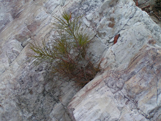
"In the Pines"


Finally at the top of Flint Mountain.

Green's Pond.

Non-Wilderness trail, part of the hike out

The View from the Top.


Carson is tired after the hike up the mountain.

Camp ground along the trail.

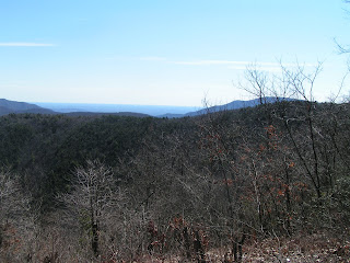
Another view from the top.

Yes there is a broken down bus at the top of the Mountain. It seems to belong to the Lofton Gang.


There was a fork in the road, Carson wanted to take the "trail less traveled".


Switchbacks on the way out, fun straight down into the hollow.

Jess and the big Hemlock

Trail had some good debris to climb over


SUCCESS!

Perseverance (St. Mary's Wilderness - Day 1)


Returning from St. Mary's Falls to make camp

PERSEVERANCE


Climbing up the small cliff.


The Roaring Water in the River closest to the Falls.


Walking along the River.

Carson leading the way to camp.

We had good, dry trails... NOT.

Fishing for Carson